
Planning your trip
Peguis Canyon, Chihuahua: From Presidio or Chihuahua City, the Lookout and the River
A 350 m 1,150 ft deep gorge of the Conchos River, 47 km 29 mi from the Presidio bridge: crossing at Ojinaga, the permits, the guided trip, the lookout, safety and weather.
Saved on this device: you can read this guide without signal.
Email me this guide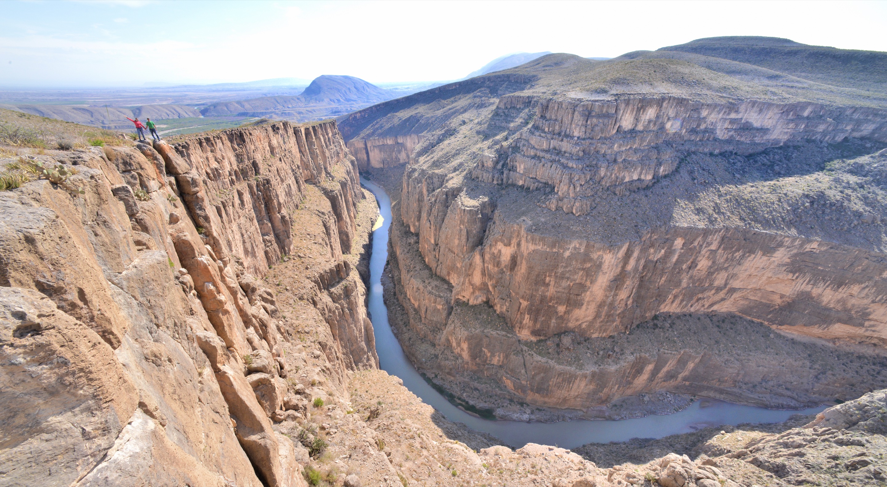
Where the Conchos River cuts through a desert range in sheer limestone walls up to 350 m 1,150 ft high, on the highway between Chihuahua City and Ojinaga, across the Rio Grande from Presidio, Texas.
Peguis Canyon (Cañón del Pegüis in Spanish) is closer to Texas than to the state capital: the roadside lookout is 47 km 29 mi by road from the Presidio–Ojinaga bridge and 189 km 117 mi from Chihuahua City. That makes it a natural side trip for anyone visiting Big Bend, and it also means the paperwork and the safety picture are different from the rest of our guides. This page puts them in one place.
If you would rather not drive, there is a guided day trip from Chihuahua City with hotel pickup and a bilingual guide: Peguis Canyon Tour on Civitatis. The details are below, followed by the drive from each side.
Key facts
| What it is | A narrow gorge of the Conchos River through a desert range, with vertical limestone walls |
| Where | Municipality of Ojinaga, state of Chihuahua, on highway MEX 16 · lookout at 29.506° N, 104.765° W |
| Size | About 16 km 10 mi long and up to 350 m 1,150 ft deep; in places the walls are only 8 to 10 m (26 to 33 ft) apart |
| From the Presidio–Ojinaga bridge | 47 km 29 mi by road, about 45 minutes, to the lookout |
| From Chihuahua City | 189 km 117 mi, about 2 h 55 min, to the lookout |
| Ways to see it | A free roadside lookout open at all hours, and a riverside park with boat rides (daily 10 a.m.–7 p.m., MXN 100 entry) |
| Guided day trip | About 8 hours from Chihuahua City, hotel pickup, guide in English and Spanish · MXN 1,700 (about US$91) per person |
| Paperwork from the U.S. | Passport, FMM entry permit and, for a U.S. car, a temporary vehicle import permit: the canyon is beyond the 20 km 12 mi border strip |
| Altitude | About 830 m 2,710 ft at river level |
| Best months | October–November and February–April; May to September are very hot |
What the canyon is like
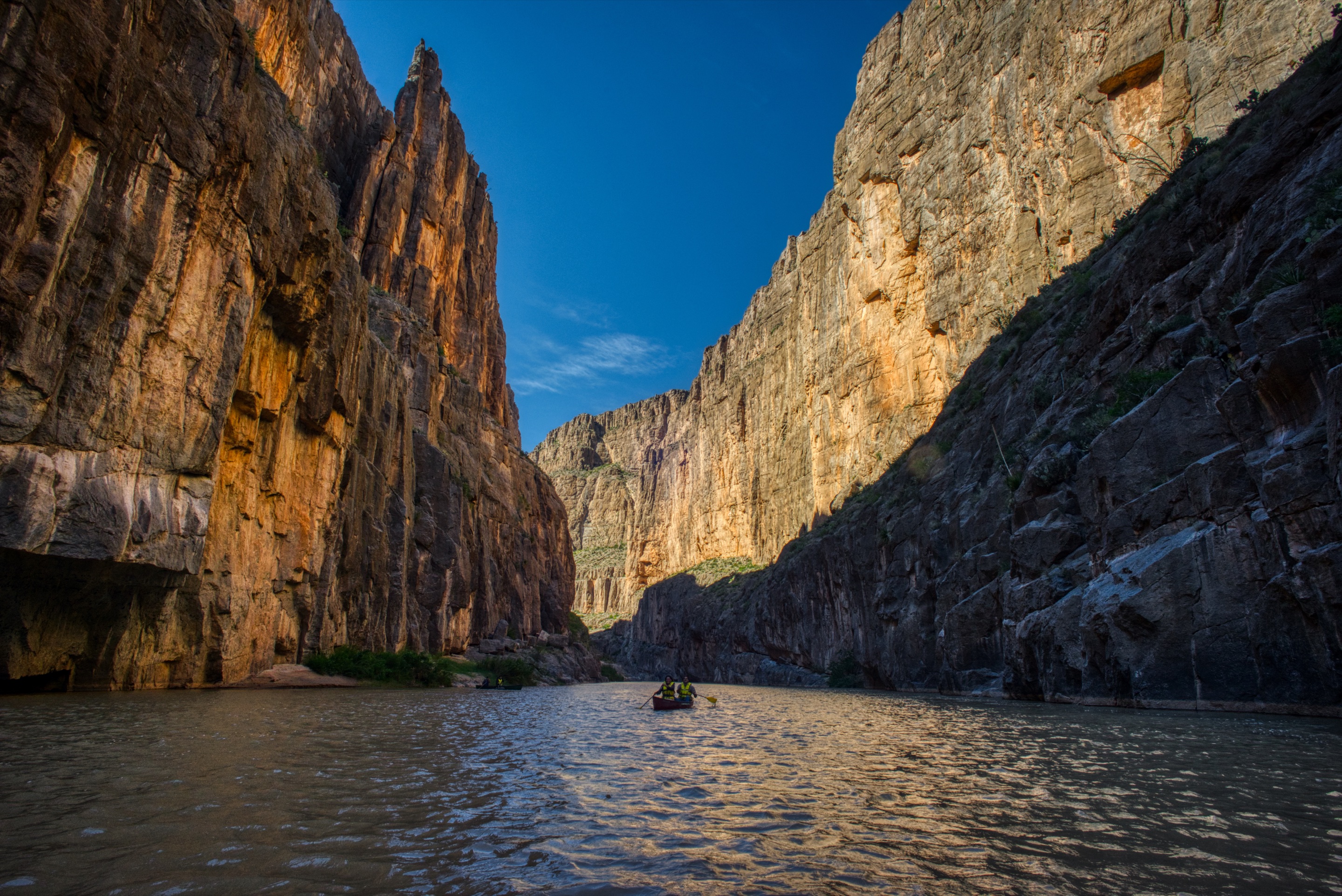
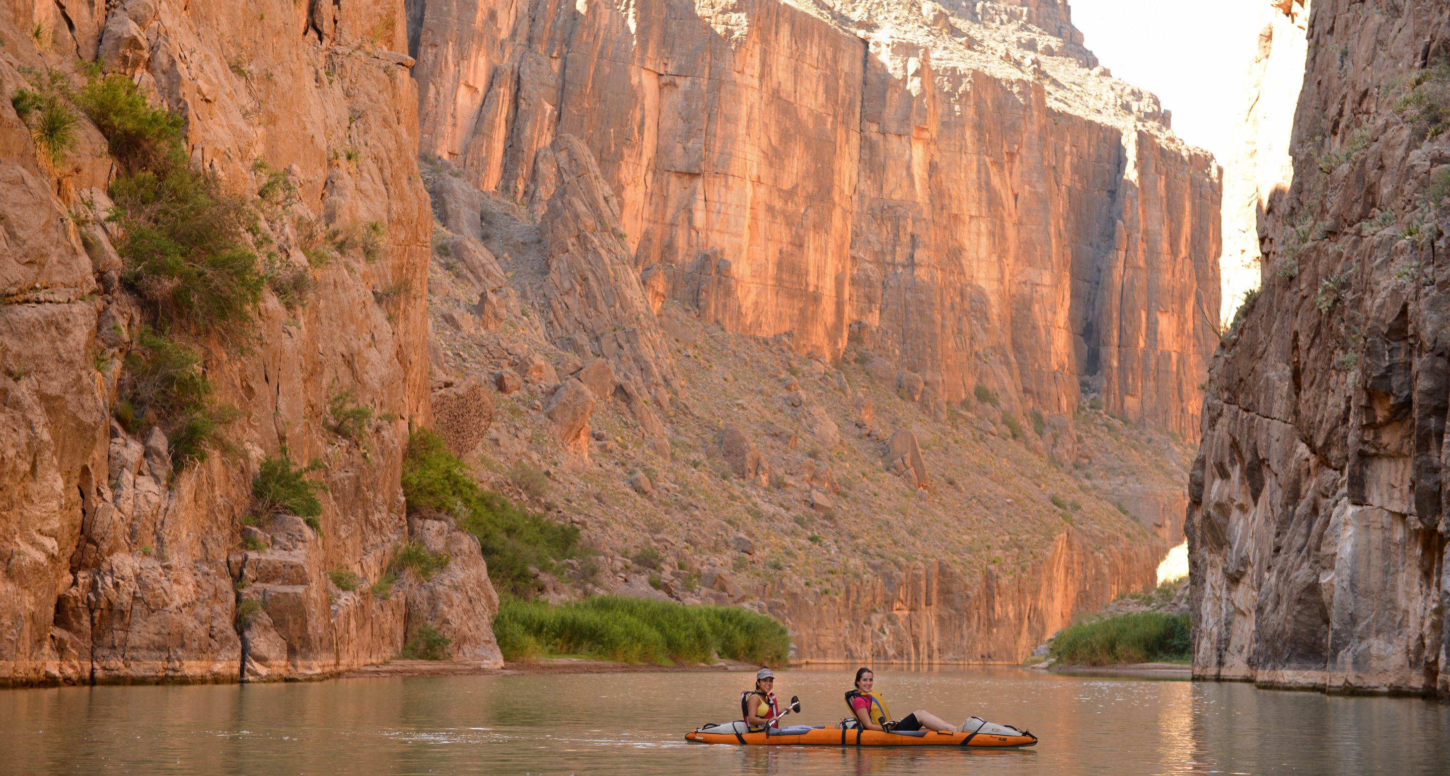
On its way across the Chihuahuan Desert toward the Rio Grande, the Conchos meets a range of limestone at Peguis and has cut straight through it, leaving a gorge about 16 km 10 mi long and up to 350 m 1,150 ft deep. The walls are almost vertical, and in the narrowest stretches they stand only 8 to 10 m (26 to 33 ft) apart and squeeze the river between them. It is a landscape made by erosion over very long periods: desert above, a slot of rock and water below.
Upstream, the river passes the tiny community of El Álamo before it enters the range. Downstream, beyond the canyon, it flows on to join the Rio Grande just north of Ojinaga.
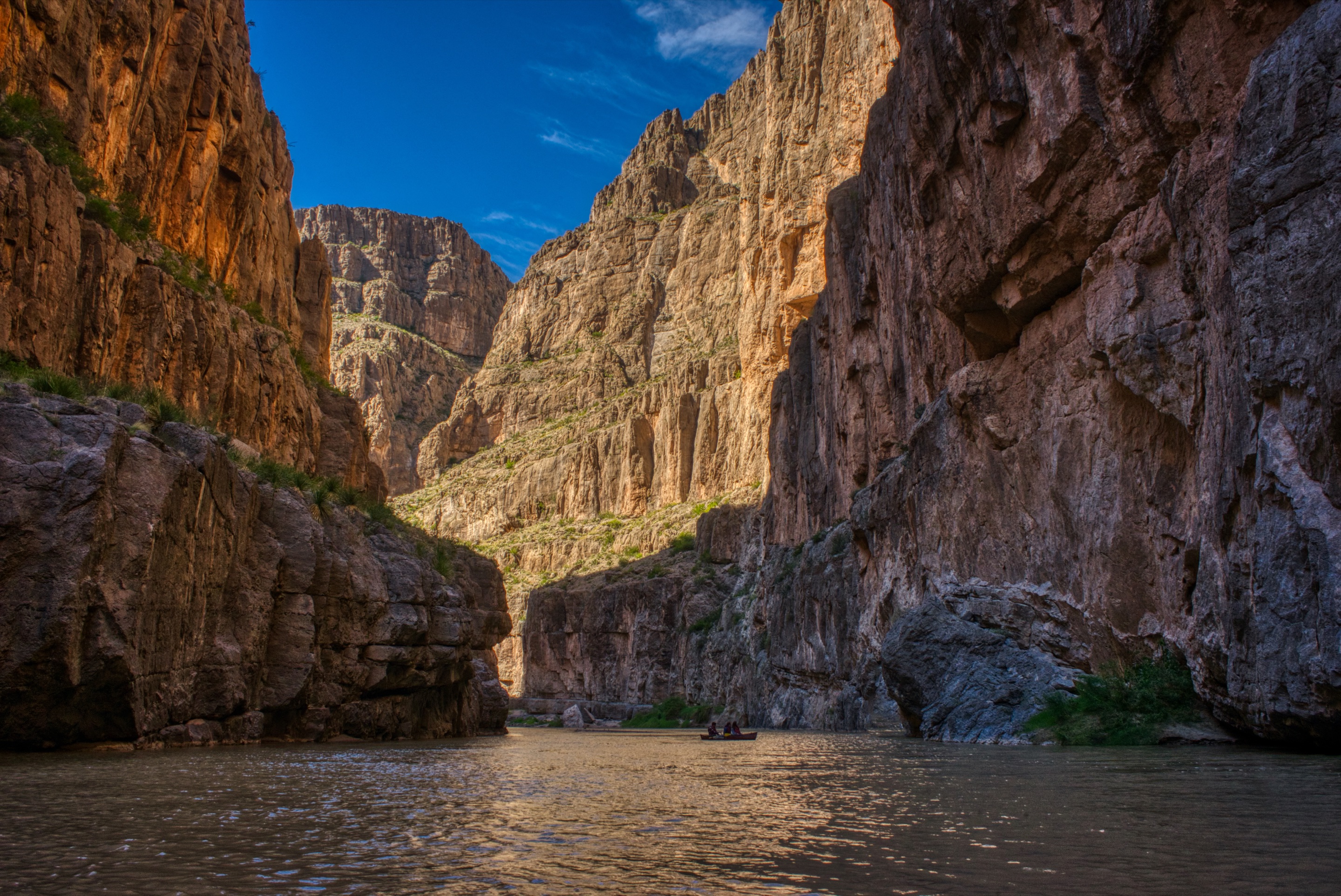
There are two ways to see it, and they are very different:
- From above, at the lookout. A parking area on MEX 16 looks down into the canyon. It is free, always open and the quickest way to see the canyon.
- From the river, at the ecotourism park. A riverside park east of the lookout gives family access to the canyon at water level, where you can hire a guided boat ride into the gorge.
We found no official information on hiking trails inside the canyon or on running its full length by raft or kayak. If a full descent is your plan, go only with an experienced outfitter and ask about water levels and obstacles before you commit. We also found no published decree making the canyon a protected natural area, although some travel sites describe it as one.
Rock art and legends
You will read that ancient paintings and carvings mark the canyon's walls, and that the place is "full of legends." We looked for an official description of either, from the state tourism office or from INAH, Mexico's archaeology institute, and found none we could verify: no location, no age, no protected site open to visitors. So we cannot tell you where to look or what the stories say. If a guide shows you rock art, look but do not touch it, chalk it or wet it for a photograph; in Mexico, archaeological remains are protected by federal law.
The easy way: the guided day trip from Chihuahua City
For visitors already in Chihuahua City, the guided trip is the simplest way to see Peguis: someone else drives the three hours to the canyon on MEX 16, and the day includes a stop at the caves of Coyame along the same highway.
| Name | Peguis Canyon Tour |
| Duration | About 8 hours (8 to 9 hours, door to door) |
| Starts | Pickup at your hotel in Chihuahua City |
| Route | About 3 hours by road, past Cuchillo Parado · a one-hour guided visit to the Grutas de Coyame caves · Peguis Canyon, walking below walls of more than 300 m 984 ft, with an optional one-hour boat ride on the Conchos · free time for a snack · back to your hotel |
| Includes | Hotel pickup and drop-off, transport by bus or minibus, an English-speaking guide |
| Not included | Food and drinks · the boat ride, MXN 300 per person · entry to the Grutas de Coyame, MXN 100 per person |
| Language | Guide in English and Spanish |
| Price | MXN 1,700 per person, about US$91 |
| Cancellation | Free up to 48 hours before; no refund after that or for no-shows |
| Booking window | Up to 1 day in advance, if seats remain |
| Voucher | Electronic, shown on your phone |
Three things to know before you book:
- The boat ride runs only on Saturdays and Sundays. If the river is the reason you are going, book a weekend date.
- The caves can be closed. Access to the Grutas de Coyame depends on the local authorities, so that stop may not happen on your day.
- Bring pesos and food. Lunch is not included, the boat and cave fees are paid on the spot, and the listing does not say whether the park's entry is included; ask when you book.
From Presidio and Big Bend: crossing at Ojinaga
Presidio, Texas, and Ojinaga, Chihuahua, face each other across the Rio Grande, joined by an international bridge. From the Mexican end of the bridge, MEX 16 runs west out of Ojinaga and reaches the lookout in about 45 minutes. On a map it looks like an easy afternoon. In practice it means entering Mexico properly, with a car permit if you drive your own vehicle, and every government we checked has something to say about that drive (see the safety section below).
Getting to the bridge
| From | Distance | Driving time | Route |
|---|---|---|---|
| El Paso | 415 km 258 mi | about 4 h 35 min | I-10, US 90 and US 67 to Presidio |
| Big Bend National Park (Panther Junction) | 155 km 96 mi | about 2 h 25 min | TX 118 to Study Butte, then FM 170 along the river |
FM 170, the road from Study Butte to Presidio, is also one of the ways into Big Bend National Park from the west, so the canyon fits naturally into a Big Bend trip. The U.S. port of entry at Presidio lists its hours as open all day, every day.
Paperwork for a U.S. visitor
The question everyone asks is whether the border zone rules let you skip the permits. They do not. Mexico's customs law defines the border strip as the land within 20 km 12 mi of the international line. The lookout is about 28 km 17 mi from the border in a straight line, so it lies outside that strip, and the rules for traveling into the interior apply:
- Passport. By land you need a passport book or a passport card. If you fly home, a passport card is not valid to board a plane.
- FMM entry permit. The U.S. government explains that every traveler to Mexico needs an FMM, except those staying within 20 km 12 mi of the border for six days or less. The canyon is beyond that line, so get the FMM online from Mexico's immigration institute or at an office of the institute (INM).
- Temporary vehicle import permit (TIP) for a U.S. car. A U.S.-registered vehicle needs a Banjercito permit to go beyond the border zone, with a refundable deposit. The states where you can drive without one are Baja California, Baja California Sur and Sonora, not Chihuahua. Banjercito has a permit office at the Ojinaga international bridge, open 24 hours, every day, so you can get it as you cross. We could not confirm the current fee, deposit and list of documents in an official source, so check them with Banjercito before you go, carry a credit card in the driver's name, and ask how to recover the deposit when you leave.
- Mexican auto insurance. Third-party liability insurance is required on Mexico's federal highways, and MEX 16 is one; buy a Mexican policy before you cross. Our driving guide covers the details.
Keep the permits within reach: maps show a customs building beside the highway just west of the lookout.
The drive from Ojinaga
From the bridge, follow the city's main avenues to MEX 16, the Chihuahua–Ojinaga highway, and head west. The highway is paved and runs through open desert for about 43 km 27 mi to the lookout, which has its own parking area beside the highway. For the riverside park, a turn off MEX 16 leads to an unpaved road of about 2.8 km 1.8 mi down to the river; drive it slowly, and do not try it after heavy rain.
We found no fuel station on the map between Ojinaga and the canyon, so fill the tank and buy water in Ojinaga or Presidio, and plan to be back across the bridge well before dark.
From Chihuahua City by car
From Chihuahua City, MEX 16 leaves town to the northeast, bypasses Aldama, and crosses about 190 km 118 mi of desert past Coyame and Cuchillo Parado before reaching the canyon. Leave early: it is close to three hours each way without stops, and the U.S. advisory asks travelers not to drive between cities after dark.
Distances and driving times to the lookout
| From | Distance | Driving time | Route |
|---|---|---|---|
| Presidio–Ojinaga bridge | 47 km 29 mi | about 45 min | MEX 16 west |
| Ojinaga | 43 km 27 mi | about 40 min | MEX 16 west |
| Cuchillo Parado | 41 km 25 mi | about 45 min | CHIH 204, then MEX 16 east |
| Coyame | 46 km 28 mi | about 45 min | MEX 16 east |
| Chihuahua City | 189 km 117 mi | about 2 h 55 min | MEX 16 northeast, around Aldama |
| Big Bend National Park (Panther Junction) | 194 km 120 mi | about 3 h | TX 118, FM 170, the bridge, then MEX 16 |
| Creel | 447 km 278 mi | about 6 h 40 min | CHIH 25 to La Junta, then MEX 16 through Chihuahua City |
Times are for a car with no stops and do not include the border crossing. The riverside park is a further 7 km 5 mi, about 15 minutes, from the lookout, the last part on the unpaved road. From Creel the canyon is not a sensible day trip; spend the night in Chihuahua City first.
At the canyon: the lookout and the river park
| The lookout | The ecotourism park | |
|---|---|---|
| What you see | The gorge from above, from the edge of MEX 16 | The canyon from the river, at water level |
| Hours | Always open | Daily, 10 a.m. to 7 p.m. |
| Entry | Free | MXN 100 |
| Getting in | Parking beside the highway | 2.8 km 1.8 mi of unpaved road from MEX 16 |
| What to do | Look, photograph, stretch your legs | Guided boat rides into the canyon, time by the water |
| Phone | — | +52 626 100 1800 |
The lookout works as a short visit: half an hour is plenty for the view and photographs, and in summer the morning is the time to be there.
The park is for those who want to be on the water: its guided boat rides are the way to see the canyon from below without an expedition. Call ahead to ask whether boats are running on your date, especially outside weekends; the guided tour runs its boat ride on Saturdays and Sundays only.
On accessibility: the lookout is about 150 m 500 ft from its parking area as mapped, while the road down to the park is unpaved. We found no official accessibility information for either, and the guided tour does not publish any, so ask before you book if you have reduced mobility.
When to go: weather by month
The closest long-term weather records we found are from Presidio, Texas, about 39 km 24 mi east of the lookout at 796 m 2,610 ft, almost the same altitude as the river in the canyon. These are its averages for 1991–2020:
| Month | Average high | Average low | Rain | Days with 0.1 in (2.5 mm) or more |
|---|---|---|---|---|
| Jan | 20 °C 68 °F | 1 °C 34 °F | 0.48 in (12 mm) | 1.2 |
| Feb | 23 °C 74 °F | 5 °C 41 °F | 0.43 in (11 mm) | 1.0 |
| Mar | 27 °C 81 °F | 9 °C 48 °F | 0.52 in (13 mm) | 0.5 |
| Apr | 32 °C 90 °F | 13 °C 56 °F | 0.17 in (4 mm) | 0.6 |
| May | 36 °C 98 °F | 19 °C 66 °F | 0.41 in (10 mm) | 1.4 |
| Jun | 40 °C 103 °F | 23 °C 74 °F | 1.04 in (26 mm) | 1.8 |
| Jul | 38 °C 101 °F | 24 °C 75 °F | 1.84 in (47 mm) | 3.6 |
| Aug | 38 °C 100 °F | 24 °C 75 °F | 1.42 in (36 mm) | 2.7 |
| Sep | 35 °C 95 °F | 21 °C 69 °F | 0.95 in (24 mm) | 2.3 |
| Oct | 31 °C 88 °F | 14 °C 58 °F | 0.70 in (18 mm) | 1.4 |
| Nov | 25 °C 77 °F | 7 °C 45 °F | 0.48 in (12 mm) | 0.8 |
| Dec | 20 °C 68 °F | 2 °C 35 °F | 0.48 in (12 mm) | 0.9 |
What that means for planning:
- October, November, February, March and April are the most comfortable months: warm afternoons, cool mornings and very little rain.
- May to September are hot. June averages a high of 40 °C 103 °F, and July and August are barely cooler. If you go in summer, be at the lookout early in the morning, carry plenty of water and avoid the midday sun.
- June to September bring about three fifths of the year's rain, mostly as short storms. After heavy rain, skip the unpaved road to the park.
- December and January have average lows just above freezing. Middays are pleasant; mornings are cold.
The year's total averages only 8.9 in (227 mm) of rain. For the rest of the state, including Creel and the train, see our best time to visit Copper Canyon.
What it costs
| Item | Cost |
|---|---|
| Guided day trip from Chihuahua City | MXN 1,700 per person (about US$91) |
| Boat ride on the tour (weekends only) | MXN 300 per person |
| Grutas de Coyame entry on the tour | MXN 100 per person |
| The roadside lookout | Free |
| The ecotourism park, on your own | MXN 100 entry; ask the price of boat rides when you call |
| Temporary vehicle import permit and deposit | We found no current official figure; check with Banjercito |
| Mexican auto insurance | Varies by policy and days; buy it before you cross |
| Hotel in Presidio or Chihuahua City | Varies by date; see the box at the end |
Is it safe to visit Peguis Canyon from the U.S.?
Here is what the governments say, so you can decide with the same information we have.
- United States: the State Department's advisory for Mexico issued on May 29, 2026 places the state of Chihuahua at Level 3, Reconsider travel, due to terrorism, crime and kidnapping, and says U.S. government employees may not travel to certain areas of the state. Among the restrictions for its employees that it strongly advises U.S. citizens to follow: do not travel between cities after dark, avoid traveling alone, especially in remote areas, and do not drive between Mexican border cities and the interior of Mexico, with limited exceptions. Driving from Ojinaga, a border city, to the canyon 43 km 27 mi inland is the kind of trip that restriction describes. The advisory comes with a map of the areas restricted for its employees; read it before you decide. We could not confirm the current Chihuahua details of that map.
- United Kingdom: the UK government advises against all but essential travel to the state of Chihuahua, except Chihuahua City, the border crossing at Ciudad Juárez on highway 45 and the 45D toll road to Chihuahua, the Copper Canyon rail route and the towns on it including Creel, the road from Creel through San Juanito to San Pedro, and highway 16 from San Pedro to Chihuahua. Ojinaga, the Chihuahua–Ojinaga stretch of highway 16 and the canyon are not among those exceptions.
- Canada: the Canadian government advises avoiding non-essential travel to the state of Chihuahua, excluding Chihuahua City. The canyon and Ojinaga are outside the city.
In practice:
- Go in daylight, both ways, and plan to be back across the bridge, or in Chihuahua City, before dark.
- Do not go alone. Travel with company or with the guided trip, and stay on MEX 16.
- Tell someone your plan and when you expect to be back, and keep your phone charged.
- Check your insurance. Some travel policies limit cover in areas under an official advisory; ask your insurer in writing. Our travel insurance guide lists the questions to ask.
We do not promise that a place is safe or unsafe beyond what these governments publish. For the wider picture of the region, see Copper Canyon safety: what to know.
What to bring
Combine it with
- Big Bend: from Presidio, FM 170 follows the Rio Grande to Study Butte, about 26 miles (42 km 26 mi) west of Big Bend National Park headquarters. The canyon and the park make a natural pair on a West Texas trip.
- Coyame and Cuchillo Parado: both are on MEX 16 on the Chihuahua City side; the guided trip passes Cuchillo Parado and stops at the caves of Coyame. Coyame, founded in 1715 as a mission, has a hot-spring pool complex at km 142 of the highway, and the Grutas de Coyame caves, run by the municipality, open Wednesday to Sunday from 9 a.m. to 4 p.m., with a one-hour visit. Cuchillo Parado is the home town of Toribio Ortega, a precursor of the Mexican Revolution; every November 14 the state's three branches of government travel there for a civic ceremony in his honor.
- Chihuahua City: the guided trip starts and ends here. See our things to do in Chihuahua and the hub Chihuahua beyond the train.
- More from the border: the Samalayuca dunes are the equivalent trip from El Paso, with the same paperwork questions.
- More day trips from Chihuahua City: Namúrachi Canyon, Basaseachi Falls and Paquimé and Mata Ortiz.
- Copper Canyon and Creel: a different trip, best done by train. Start with our Copper Canyon train guide and Chihuahua to Creel.
Frequently asked questions
Where is Peguis Canyon?
On the Conchos River in the municipality of Ojinaga, Chihuahua, beside highway MEX 16. The roadside lookout is 43 km 27 mi west of Ojinaga, 47 km 29 mi from the Presidio–Ojinaga bridge and 189 km 117 mi from Chihuahua City.
How deep is Peguis Canyon?
Up to 350 m 1,150 ft at its deepest point, along a gorge about 16 km 10 mi long. In the narrowest stretches the walls are only 8 to 10 m (26 to 33 ft) apart.
Can I visit Peguis Canyon from Presidio, Texas, without a car permit?
Not with a U.S. car. The canyon is about 28 km 17 mi from the border in a straight line, beyond the 20 km 12 mi border strip, so a U.S.-registered vehicle needs a Banjercito temporary import permit. Banjercito has an office at the Ojinaga international bridge, open 24 hours every day. Every traveler also needs a passport and an FMM entry permit, and the car needs Mexican insurance.
Is there a tour to Peguis Canyon?
Yes. An 8-hour day trip from Chihuahua City includes hotel pickup, transport and a guide in English and Spanish, for MXN 1,700 (about US$91) per person. It also stops at the Grutas de Coyame caves. Food, the boat ride (MXN 300, weekends only) and the cave entry (MXN 100) are not included.
How much does it cost to visit Peguis Canyon?
The roadside lookout is free and always open. The riverside ecotourism park charges MXN 100 and opens daily from 10 a.m. to 7 p.m.
What is the best time to visit Peguis Canyon?
October, November and February to April are the most comfortable. From May to September average highs reach 98–103°F (36–40°C), so go early in the day if you visit then.
Is Peguis Canyon safe to visit?
The U.S. advisory places Chihuahua at Level 3, Reconsider travel, and strongly advises U.S. citizens not to drive between Mexican border cities and the interior or between cities after dark. The UK and Canadian governments advise against non-essential travel to the area of the canyon. Read the current advisories in full, travel in daylight and not alone, and consider the guided trip.
Recommended hotels
Recommended tours
Send me this guide
Everything on this page in your inbox: the schedules and the booking links. Handy for planning, printing or reading on the train.
Sources
- Government of Chihuahua, Secretariat of Tourism: Desert region brochure
- Government of Chihuahua, Secretariat of Tourism, Atlas Turístico: Peguis Canyon lookout
- Government of Chihuahua, Secretariat of Tourism, Atlas Turístico: Peguis Canyon ecotourism park
- INEGI: catalog of localities, Ojinaga
- INEGI: catalog of localities, Coyame del Sotol
- Ley Aduanera, article 136: the border strip
- Federal Law on Archaeological, Artistic and Historic Monuments and Zones
- Banjercito: directory of vehicle permit modules
- Instituto Nacional de Migración: FMM online application
- U.S. Customs and Border Protection: Presidio port of entry
- National Park Service: directions to Big Bend National Park
- NOAA National Centers for Environmental Information: monthly climate normals for Presidio, Texas
- U.S. Department of State: Mexico travel advisory
- U.S. Embassy in Mexico: contact and emergencies
- Diario Oficial de la Federación: third-party insurance on federal highways
- UK Foreign, Commonwealth & Development Office: Mexico travel advice
- Government of Canada: travel advice for Mexico
- OpenStreetMap: road and track data (© OpenStreetMap contributors, ODbL)