
Planning your trip
Samalayuca Dunes from El Paso or Chihuahua: Getting There, Permits, Safety and Weather
Mexico's tallest dunes, 54 km 34 mi from the El Paso bridges: the drive, the vehicle permit at Km 30, what three governments advise, rules and weather.
Saved on this device: you can read this guide without signal.
Email me this guide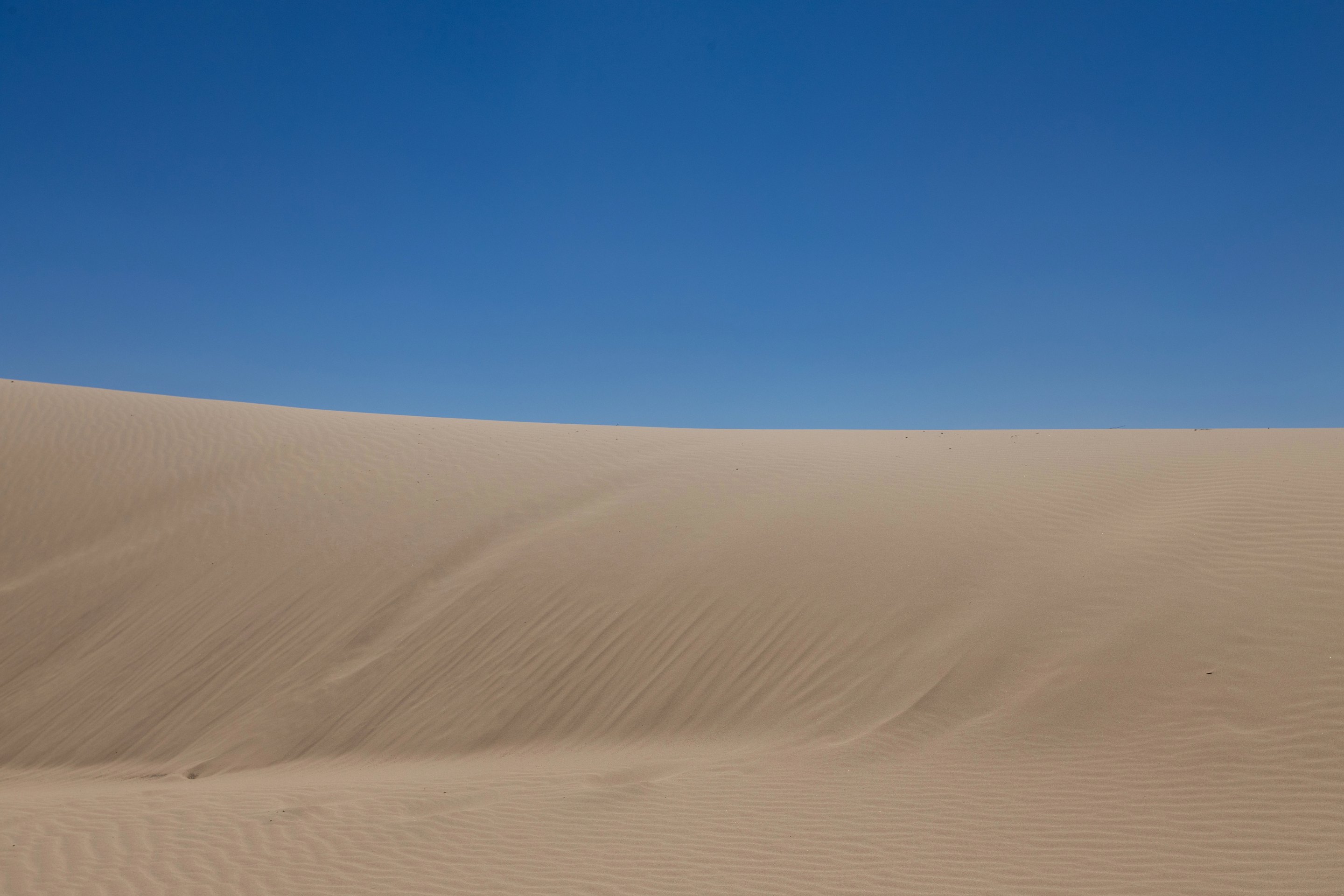
A sea of nearly pure silica sand, with dunes up to 120 m 394 ft tall, about an hour's drive south of the El Paso bridges.
The Médanos de Samalayuca are the closest of all our Chihuahua destinations to the United States. That makes them tempting as a day trip from El Paso, and it also makes the paperwork and the safety picture different from the rest of the state: the dunes sit just outside the border zone, on a highway that every government we checked treats in its own way. This guide puts the drive, the permits, the official advice, the reserve's rules and the weather in one place, so you can decide with all of it in front of you.
If you would rather not drive, there is a guided sandboarding day trip from Chihuahua city on Civitatis with hotel pickup, an English-speaking guide, boards and lunch; the details are below.
Key facts
| What it is | A field of wind-blown silica sand on the old shoreline of a vanished Ice Age lake, inside a federal flora and fauna protection area |
| Where | South of Ciudad Juárez, next to the village of Samalayuca, off highway MEX 45 |
| From the El Paso bridges | About 54 km 34 mi, roughly 1 hour of driving, plus the wait at the border |
| From Chihuahua city | About 328 km 204 mi, roughly 4 hours 30 minutes |
| Size | The sand sea covers about 140 km² (54 sq mi); the protected area around it, 63,182 ha (244 sq mi) |
| Dune heights | Most active dunes are 4–5 m (13–16 ft); a chain of "megastar" dunes on the eastern ridge reaches about 120 m 394 ft |
| Protected since | June 5, 2009 (federal decree) |
| Paperwork from the U.S. | Passport, FMM entry permit and, if you drive a U.S. car, a temporary vehicle import permit, which you can get at the Km 30 checkpoint on MEX 45, open 24 hours |
| Best months | October to April; June is the hottest month, July and August the wettest |
| Entry fee | We found no official published fee; carry pesos in cash |
| Allow | Our suggestion: a full day from El Paso, with the drive back in daylight |
What the dunes are
During the Ice Age, a large lake called Palomas spread across what is now the Chihuahuan Desert in northern Mexico. The Rio Grande once flowed into it and left sand along its shores. As the climate changed and the lake dried up, the wind kept pushing that sand east until it piled up in front of two small mountain ranges, the Sierra de Samalayuca and the Sierra del Presidio. Geologists call these "echo dunes": sand that builds up on the upwind side of a mountain obstacle.
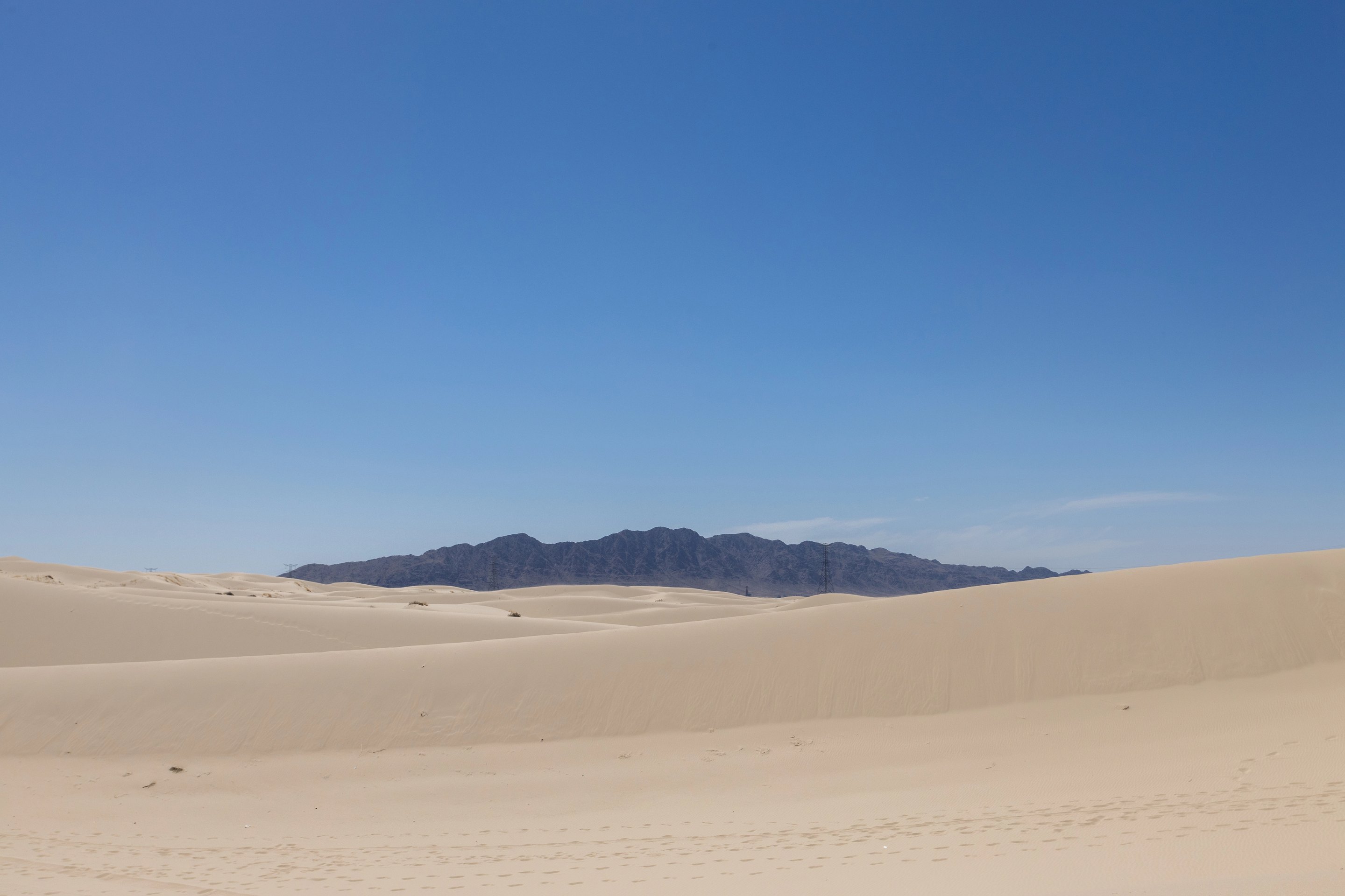
The sand is 90 to 95 percent silica. Today the main body of the dune field covers about 114 km² (44 sq mi), with a smaller field of about 26 km² (10 sq mi) to the northwest.
Most of the active dunes are modest, 4 to 5 m (13 to 16 ft) high, with crests running in two directions at once, so the surface looks like a crisscross of ripples. Underneath them run much older ridges, about 50 m 164 ft high and roughly 1 km 0.6 mi apart. On the easternmost ridge rises a chain of at least 15 giant star-shaped dunes, the largest up to about 120 m 394 ft. They are considered the tallest dunes in Mexico.
Where visitors go
Most of the protected area is set aside for conservation. The reserve's zoning gives visitors a public-use zone of about 524 ha (1,294 acres) in two parts, both in the north of the protected area:
- The tourist area in the ejido of Villa Luz, about 23 ha (57 acres) of dunes and mesquite with dirt tracks used for cross-country cycling, a motocross track and services for visitors: a restaurant, stands and parking.
- El Presón, about 500 ha (1,236 acres) around a dry reservoir, with camping areas, a swimming area and an area for ATVs.
We found no current official list of what is open or of opening hours, so ask your guide or operator before you go.
How far it is, and how long it takes
| From | Distance | Driving time, no stops | Main roads |
|---|---|---|---|
| Downtown El Paso (San Jacinto Plaza) | 55 km 34 mi | about 59 min | a downtown bridge, Eje Vial Juan Gabriel, Bulevar Óscar Flores, MEX 45 |
| Bridge of the Americas | 54 km 34 mi | about 59 min | Bulevar Óscar Flores, MEX 45 |
| Ysleta–Zaragoza bridge | 55 km 34 mi | about 57 min | Avenida Ejército Nacional, Avenida de las Torres, MEX 45 |
| Chihuahua city | 328 km 204 mi | about 4 h 31 min | MEX 45 and MEX 45D north through Villa Ahumada |
| Creel | 585 km 363 mi | about 8 h 13 min | CHIH 25, MEX 16 to Chihuahua, then MEX 45 north |
Distances run to the dunes' visitor area east of the village of Samalayuca; the village itself is about 5 km 3 mi closer. The times do not include the border crossing, which can add a long wait in either direction, so check the current wait at U.S. Customs and Border Protection's border wait times page before you leave and again before you head back.
Getting there from El Paso
Crossing the border
These El Paso bridges take cars into Ciudad Juárez:
- Bridge of the Americas (3600 E. Paisano): passenger-vehicle lanes open 24 hours, seven days a week.
- Stanton–Lerdo (1001 S. Stanton): three southbound lanes for passenger vehicles.
- Ysleta–Zaragoza (791 S. Zaragoza): has an E-Fast Pass lane for cars going south.
The Paso del Norte bridge on El Paso Street is for pedestrians in both directions and carries cars only northbound, so it is not a way to drive into Mexico.
The drive south
From any of the bridges, follow the boulevards south through Ciudad Juárez to MEX 45, the Pan-American Highway toward Chihuahua. Once out of the city, the highway runs through open desert. At Km 30 you pass Mexico's customs checkpoint for vehicles leaving the border zone, with a Banjercito permit office open 24 hours every day (more on that below). Near the village of Samalayuca, about 50 km 31 mi from the bridges, a side road leads east to the dunes' visitor area.
Drive it in daylight both ways. The U.S. advisory tells its own employees not to travel between cities after dark, and it strongly advises U.S. citizens to follow that restriction.
Paperwork for a day trip from the U.S.
This is the part that catches people out. Mexico's customs law defines the border strip as the land within 20 km 12 mi of the international line. The dunes' visitor area is about 24 km 15 mi from the border in a straight line, so it lies just outside that strip, and the rules that apply are those for traveling into the interior:
- Passport. By land, a U.S. passport book or passport card. If you are flying home from somewhere else, remember that a passport card is not valid to board a plane.
- FMM entry permit. The U.S. government explains that every traveler to Mexico needs an FMM, except those staying within 20 km 12 mi of the border for six days or less. The dunes are beyond that line, so get the FMM, either online from Mexico's immigration institute or at an INM office.
- Temporary vehicle import permit (TIP). A U.S.-registered car needs a Banjercito permit to go beyond the border zone, with a refundable deposit, and Chihuahua is not one of the states where you can drive without it. The Banjercito module at the Km 30 checkpoint on MEX 45, on the Ciudad Juárez–Samalayuca stretch, is open 24 hours, every day, so you can get the permit on the way. We could not confirm the current fee, deposit and list of documents in an official source, so check them with Banjercito before you go, and carry a credit card in the driver's name. Before you return to the U.S., have the permit cancelled so the deposit comes back.
- Mexican liability insurance. Every vehicle on Mexico's federal highways must carry insurance that covers damage to third parties; your U.S. policy is not enough. Buy a Mexican policy before you cross.
- Customs. By land, declare goods worth more than US$300.
If you are driving a rental car, check before you book that the contract allows it to enter Mexico. Our guide to driving to the Copper Canyon covers the same paperwork in more detail.
Getting there from Chihuahua city
From Chihuahua city, the dunes are about 328 km 204 mi north on MEX 45 and the toll road MEX 45D through Villa Ahumada: about 4 hours 30 minutes of driving each way without stops. That is a long day out and back, and it puts you in the desert for only a few hours, so if you are already in Chihuahua for the city or El Chepe, a tour is the simpler way to do it.
The guided day trip from Chihuahua
The Samalayuca Dunes Sandboarding Tour on Civitatis starts and ends at your hotel in Chihuahua city:
| Duration listed | 8 hours |
| Includes | Hotel pickup and drop-off, transport by minibus, an English-speaking guide, sandboarding equipment, lunch and drinks |
| Language | A guide who speaks English and Spanish |
| On the dunes | About 2 to 3 hours of sandboarding, with instruction on how to do it safely |
| Lunch | In the village of Samalayuca: burritos in the style of Villa Ahumada, the town on the highway known for them |
| Minimum age | 8 years |
| Price | From US$176 per person (MXN 3,300) |
| Cancellation | Free up to 48 hours before the start |
One thing to ask before you book: the listing gives 8 hours, while our route data puts the drive alone at about 4 hours 30 minutes each way. Confirm the pickup time with the operator and plan for a long day; it is not a half-day outing.
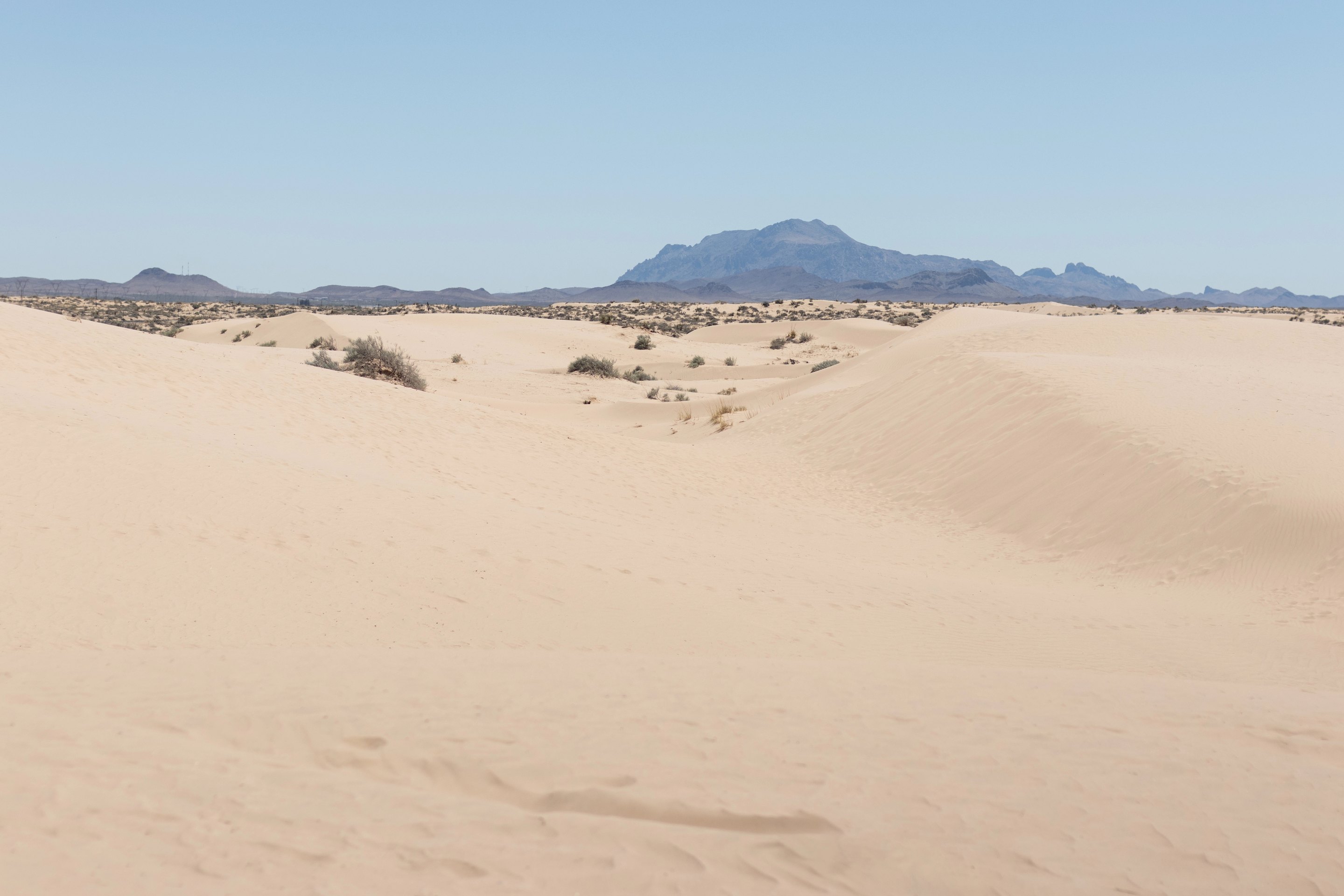
Is it safe to visit the Samalayuca dunes from the U.S.?
We will not tell you the dunes are safe or unsafe. What we can do is set out, as precisely as we can, what three governments say, because each one treats this corridor differently.
- United States. The State Department's advisory for Mexico, issued on May 29, 2026, places the state of Chihuahua at Level 3, Reconsider travel, due to terrorism, crime and kidnapping, and says U.S. government employees may not travel to certain areas of the state. Among the restrictions for its employees that it strongly advises U.S. citizens to follow: do not travel between cities after dark, and do not drive between Mexican border cities and the interior of Mexico, with limited exceptions. The dunes are outside Ciudad Juárez, on the highway toward the interior. The advisory comes with a map of the areas restricted for its employees; read it, including what it says about Ciudad Juárez and Highway 45, before you decide. We could not confirm the current Chihuahua details of that map.
- United Kingdom. The UK government advises against all but essential travel to the state of Chihuahua, except for: the city of Chihuahua; the border crossing in Ciudad Juárez, accessed by federal toll road 45; federal toll road 45D between Chihuahua and Ciudad Juárez; the Copper Canyon rail route and the towns on it, including Creel; the road from Creel via San Juanito to San Pedro; and state highway 16 from San Pedro to Chihuahua. The dunes and the village of Samalayuca are not on that list. The UK also warns that travel insurance can be invalidated if you travel against its advice.
- Canada. Canada advises avoiding non-essential travel to the state of Chihuahua, excluding Chihuahua City. The dunes fall in the area it advises avoiding.
In practice, if you decide to go:
- Go and come back in daylight, and leave the dunes with time to spare before sunset.
- Prefer a guide or a tour to driving on your own, and stay with the main visitor areas rather than wandering into remote parts of the desert.
- Tell someone in El Paso where you are going and when you expect to be back, and carry a phone that works in Mexico. Emergencies: call 911.
- Do not leave valuables visible in a parked car.
- Check your insurance covers you there; our guide to travel insurance for Mexico lists the questions to ask in writing.
Our full page on safety in Chihuahua and the Copper Canyon has the rest of the advisory, health notes and our own reading of the ground.
What to do at the dunes
Sandboarding
The long slopes are made for sandboarding, which feels like snowboarding on a slower surface. Sand is not as slippery as snow, so the steeper faces work best. Walking back up is the hard part, and it is what tires people out, not the ride down. If you have never done it, a guide who brings boards and shows you how to fall is worth it.
Walking on the sand
You do not need to do anything but walk. Climbing a dune crest early in the morning, while the sand is still cool, is the simplest and most rewarding thing to do here. Take a compass bearing or a phone pin of where you parked: from the middle of the dunes, every direction looks the same.
ATVs, buggies and off-road driving
Off-road driving is popular, and you will likely hear engines. The reserve's rules, though, limit motor vehicles to the existing roads and to the tracks and ATV area of its public-use zone; motocross and enduro are not allowed elsewhere. If an operator offers to take you across open dunes, ask where they are permitted to ride.
Photography
The low sun early and late draws out the ripples and crests, and midday light flattens them. Keep your camera in a bag between shots: wind-blown sand is hard on lenses and zoom mechanisms.
Camping
Camping is allowed only in the areas set aside for it, in the reserve's public-use zone at El Presón in the north of the protected area, which has camping areas and where campfires are permitted. It is not allowed in the preservation zones that cover the main body of the dunes or the Sierra de Samalayuca. With the U.S. and Canadian advice in mind, an overnight stay out in the desert is a decision to take with a local operator, not on your own.
The petroglyphs of the Sierra de Samalayuca
On the northwest and southeast slopes of the Sierra de Samalayuca, the rocky range next to the dunes, there are rock carvings that archaeologists date to between 1,000 and 1,500 years ago. They show bighorn sheep, human figures, masked shamans with horns, arrowheads, the sun and stars, and figures identified with the rain god Tláloc, some made by pecking the rock and some painted. In this preservation zone the reserve allows walks on interpretive trails to see the carvings, but not general tourism, so the sensible way to go is with a local guide who knows the sites. Do not touch or chalk the carvings.
Wildlife and plants
The dunes look empty, but about 248 plant species depend on the dune system. Among them are the sotol and a barrel cactus endemic to this region (*Echinocactus parryi*), both listed as threatened, and a sand prickly pear under special protection. The animals include a desert fox (*Vulpes velox neomexicana*), listed as threatened, the badger, the porcupine and the ornate box turtle, horned lizards, golden eagles and several hawks, and four species of rattlesnake. Watch where you put your hands and feet near shrubs and rocks, especially in warm weather.
The rules of the protected area
The Médanos de Samalayuca have been a federal flora and fauna protection area since June 5, 2009, covering 63,182 ha (244 sq mi) in the municipalities of Juárez and Guadalupe. These are the rules that matter to a visitor:
| You may | You may not |
|---|---|
| Walk, sandboard and take photographs | Leave any trash: take it with you |
| Drive on the existing roads | Drive motor vehicles off the existing roads, or ride motocross outside the established tracks |
| Ride ATVs in the designated area of the public-use zone | Build tracks or roads across the dunes |
| Camp and light campfires in the public-use zone at El Presón | Camp in the preservation zones (the main dunes and the Sierra de Samalayuca) |
| Visit the petroglyphs on guided interpretive walks | Remove plants, animals, fossils or archaeological pieces, or damage historic sites |
| Pay any fees that apply | Extract sand, hunt, or leave anything that could start a fire |
Tour operators working in the reserve are expected to assign a guide to each group and to carry liability insurance for their clients; it is a fair question to ask when you book.
Weather and the best time to go
The nearest station of Mexico's national weather service is in the village of Samalayuca itself, at 1,246 m 4,088 ft. It is no longer active, but it recorded the climate for almost 30 years, and these are its official normals for 1971–2000:
| Month | Average high | Average low | Rain | Days with rain |
|---|---|---|---|---|
| Jan | 14.2 °C 58 °F | -1.2 °C 30 °F | 13 mm (0.5 in) | 4 |
| Feb | 17.8 °C 64 °F | 0.9 °C 34 °F | 11 mm (0.4 in) | 3 |
| Mar | 22.4 °C 72 °F | 4.2 °C 40 °F | 8 mm (0.3 in) | 2 |
| Apr | 26.7 °C 80 °F | 7.6 °C 46 °F | 5 mm (0.2 in) | 1 |
| May | 31.5 °C 89 °F | 12.1 °C 54 °F | 13 mm (0.5 in) | 3 |
| Jun | 35.9 °C 97 °F | 17.1 °C 63 °F | 19 mm (0.8 in) | 3 |
| Jul | 35.6 °C 96 °F | 19.2 °C 67 °F | 55 mm (2.2 in) | 8 |
| Aug | 33.5 °C 92 °F | 18.5 °C 65 °F | 55 mm (2.2 in) | 8 |
| Sep | 31.3 °C 88 °F | 15.3 °C 60 °F | 47 mm (1.8 in) | 6 |
| Oct | 26.0 °C 79 °F | 8.9 °C 48 °F | 20 mm (0.8 in) | 4 |
| Nov | 19.5 °C 67 °F | 2.6 °C 37 °F | 12 mm (0.5 in) | 3 |
| Dec | 14.6 °C 58 °F | -1.0 °C 30 °F | 29 mm (1.1 in) | 4 |
The year totals about 287 mm (11.3 in) of rain. The highest temperature the station recorded was 46 °C 115 °F, in June 1994; the lowest, -14 °C 7 °F, in January 1971 and December 1978.
What that means for planning:
- October to April is the comfortable season, with highs from 58 to 80 °F (14 to 27 °C). Mornings from December to February start around freezing, so bring a warm layer even if the afternoon is pleasant.
- May to September is hot, with average highs near or above 32 °C 90 °F and records far higher. The sand in full sun is hotter than the air. If summer is your only option, be on the dunes at first light and off them by late morning.
- July and August bring the most rain, with about eight rainy days each; stay off the open sand when there is lightning.
- Wind shapes these dunes; on a windy day blowing sand stings and gets into everything. Check the forecast the day before and keep a scarf or buff for your face.
For the rest of the state, our guide to the best time to visit weighs the seasons in the sierra.
What to bring
- Water, more than you think: our suggestion is at least 2 liters (half a gallon) per person for a few hours, more in summer.
- Sun protection: hat, sunglasses and sunscreen; white sand reflects the sun back at you.
- Closed shoes or bare feet, not sandals: sand gets into sandals, and summer sand is too hot for bare feet by midday.
- A layer and a windbreaker, for cold mornings from November to March and for wind.
- A bag to carry your trash out, as the reserve requires.
- Pesos in cash for parking, food or fees, and a charged phone with an offline map.
A short history: the sand that stopped caravans
For centuries the Médanos stood across the old trade route between Mexico City and Santa Fe, the road the Spanish called El Camino Real de Tierra Adentro. For people on foot, on horseback or with oxcarts, the loose sand was one of the hardest stretches of the journey north. During the Mexican–American War, the American colonel Alexander Doniphan reported deaths among his troops as men and mules sank waist-deep into the sand, and in 1850 John Russell Bartlett, the U.S. commissioner of the boundary survey, barely got his party across, with 12 to 15 oxen pulling each wagon.
Later, the dunes found other uses. They stood in for other worlds on film, including David Lynch's *Dune* and *Conan the Destroyer*. The purity of the sand has also drawn mining interest, since sand this rich in silica is close to what the glass and ceramics industries need. Today, protection under the 2009 decree limits what can be done here, and for the people of nearby Ciudad Juárez the dunes are, above all, a place to play.
Samalayuca or White Sands?
From El Paso, the other famous dunes are at White Sands National Park in New Mexico. They are different places, and the choice depends on what you want:
| Samalayuca Dunes (Mexico) | White Sands National Park (U.S.) | |
|---|---|---|
| From downtown El Paso | 55 km 34 mi, about 1 hour plus the border | 153 km 95 mi, about 1 hour 50 minutes, no border |
| The sand | Silica (quartz), pale tan | Gypsum, white; the world's largest gypsum dune field, 275 sq mi |
| Tallest dunes | Up to about 120 m 394 ft on the eastern ridge | Great wave-like dunes of gypsum |
| Documents | Passport, FMM, and a vehicle permit and Mexican insurance for your car | None beyond what you need in the U.S. |
| Entrance | We found no official published fee | Standard pass from US$15 to US$25 |
| Sledding or sandboarding | Yes, often with a guide who brings boards | Yes, sledding is a popular activity |
| Travel advice | U.S. Level 3 for Chihuahua; UK and Canada advise against non-essential travel to this area | A domestic trip |
If you want the tallest dunes and do not mind the border and the paperwork, Samalayuca is the more dramatic place. If you want a simple day out with no border and no documents, White Sands is the easier choice.
Combine it with the rest of Chihuahua
- Chihuahua city and El Chepe: the dunes are on the highway between the border and the state capital, where the Copper Canyon train starts. Our guides to things to do in Chihuahua and riding El Chepe cover the next steps.
- Paquimé and Mata Ortiz: the other great sight of northern Chihuahua, the ancient city of Paquimé, is in the northwest of the state; see Paquimé and Mata Ortiz.
- More of the state: our hub Chihuahua beyond the train gathers the waterfalls, canyons and towns off the railway.
Printable checklist for a day trip from El Paso
Frequently asked questions
How far are the Samalayuca dunes from El Paso?
About 53 to 55 km (33 to 34 mi) from the El Paso bridges to the dunes' visitor area, roughly an hour of driving south on MEX 45, plus the time it takes to cross the border.
Do I need a vehicle permit to drive my U.S. car to Samalayuca?
Yes. The dunes are just outside the 20 km 12 mi border strip, so a U.S.-registered car needs a Banjercito temporary import permit, with a refundable deposit. The Banjercito module at the Km 30 checkpoint on MEX 45, between Ciudad Juárez and Samalayuca, is open 24 hours every day. You also need Mexican liability insurance and an FMM entry permit for each traveler.
Is it safe to visit the Samalayuca dunes?
The U.S. advisory issued on May 29, 2026 places Chihuahua at Level 3, Reconsider travel, and strongly advises U.S. citizens not to travel between cities after dark or drive between border cities and the interior. The UK advises against all but essential travel to the area of the dunes, and Canada advises avoiding non-essential travel there. If you go, go in daylight, preferably with a guide, and read the advisories in full first.
Can you camp at the Samalayuca dunes?
Only in the areas set aside for it, in the public-use zone at El Presón in the north of the protected area. Camping is not allowed in the preservation zones that cover the main dunes and the Sierra de Samalayuca.
When is the best time to visit the Samalayuca dunes?
October to April, when average highs run from 58 to 80 °F (14 to 27 °C). June is the hottest month, with average highs near 36 °C 97 °F, and July and August are the wettest.
Recommended hotels
Recommended tours
Send me this guide
Everything on this page in your inbox: the schedules and the booking links. Handy for planning, printing or reading on the train.
Sources
- Diario Oficial de la Federación: decree of the Médanos de Samalayuca flora and fauna protection area, 2009
- CONANP: management program summary, Médanos de Samalayuca (Diario Oficial, 2013)
- CONANP: Médanos de Samalayuca protected area record
- Domínguez-Acosta, Langford and Gill: Morphometry of the Samalayuca dunes, Boletín de la Sociedad Geológica Mexicana (2023)
- NASA Earth Observatory: Samalayuca Sand Dunes (2018)
- Servicio Meteorológico Nacional: climate normals for Samalayuca, station 8121 (1971–2000)
- Ley Aduanera, article 136: the border strip
- Agencia Nacional de Aduanas de México: Ciudad Juárez customs and the Km 30 checkpoint
- Banjercito: directory of vehicle permit modules (2026)
- Diario Oficial de la Federación: Acuerdo 07/2014, third-party insurance on federal roads
- City of El Paso: International Bridges
- U.S. Department of State: Mexico travel advisory
- UK Foreign, Commonwealth & Development Office: Mexico travel advice
- Government of Canada: Mexico travel advice
- National Park Service: White Sands National Park
- BBC: Samalayuca dunes, from no-go area to hot destination (2018)
- OpenStreetMap: road and track data (© OpenStreetMap contributors, ODbL)