
Planning your trip
Valleys of the Frogs and the Mushrooms near Creel, with the San Ignacio Mission
The rock valleys of the Mushrooms and the Frogs and the San Ignacio mission, about 4 km 2.5 mi from Creel: how to get there, when to go and what to bring.
Saved on this device: you can read this guide without signal.
Email me this guide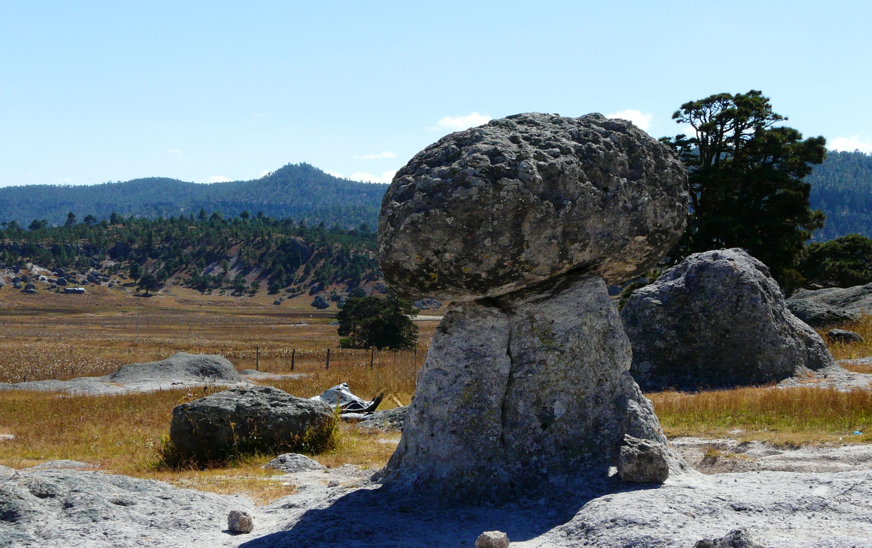
Pine and oak valleys where erosion has shaped volcanic rock into mushrooms and frogs, next to the mission church of San Ignacio de Arareco, south of Creel.
Key facts
| What it is | Valleys of eroded volcanic rock formations with trails through pine and oak forest, according to the train operator |
| Distance from Creel | Valley of the Mushrooms: 4.2 km 2.6 mi by road, about 9 minutes, or 4.1 km on foot, about 55 minutes · Valley of the Frogs: 4.3 km 2.7 mi on foot, about 1 hour |
| How to get there | The operator lists truck, ATV, horseback or walking |
| The mission | The church of San Ignacio de Arareco stands about 200 m 655 ft from the Valley of the Frogs |
| Time to allow | Our suggestion: two to three hours for both valleys and the mission |
| Entry fee | We found no official published fee; carry cash |
| Best season | Driest from March to May; rainy from July to September; average lows below freezing from November to March |
| Terrain | Trails through forest, according to the operator; no official information on accessibility |
| Bring | Layers, water, cash and shoes with grip |
What it is like
The operator describes these as valleys of volcanic rocks carved by erosion into shapes that gave them their names, with trails through a forest of several species of pine and oak. The two valleys are close to each other, about 400 m 1,310 ft apart in a straight line, and the mission church of San Ignacio de Arareco stands within about 500 m 1,640 ft of both, so one walk can cover all three. The state government lists the Valley of the Mushrooms among the top attractions of the Creel region.
A third formation, the Valley of the Monks, is farther out, about 13 km 8.1 mi by road from Creel; we will add its own page when we can confirm more about access.
Nearby
- Lake Arareco: about 3 km 1.9 mi in a straight line.
- Valley of the Monks: about 6 km 3.7 mi in a straight line.
- Back in town: our Creel guide.
Rock formations, forest and ways to get there: the train operator's Creel valleys page, read on September 16, 2026. The mission's position: OpenStreetMap. Climate: Servicio Meteorológico Nacional normals for Creel, station 8038, 1961–1990. Distances calculated on September 16, 2026 with OSRM on OpenStreetMap data (© OpenStreetMap contributors, ODbL), from the center of Creel; straight-line distances between places from the same map data. The state government's list of the Creel region's top attractions: Gobierno del Estado de Chihuahua, November 23, 2022. Cash advice: the operator's FAQ. We found no official published entry fee on September 16, 2026.
Recommended hotels
Recommended tours
Send me this guide
Everything on this page in your inbox: the schedules, the booking links and the dates we checked them. Handy for planning, printing or reading on the train.